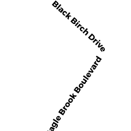
75 BLACK BIRCH DRIVE
Owner Information
DOUCETTE MATTHEW N
75 BLACK BIRCH DRIVE
WRENTHAM, MA 02093


Property Details
75 BLACK BIRCH DRIVE is classified as a Single Family Residential (Colonial).
The primary structure on this property was built in 2016. There are 3224ft2 of built area within this property. There is 1740ft2 of residential/living space within this property. This property is listed as having 6 rooms.
75 BLACK BIRCH DRIVE is valued at 217700. The land is valued at 192500 and the structures are valued at 25200.
This property is in Zone 05. Confirm with local Zoning Board authorities to ensure there are no overlays or other easements on this property.
The most recent deed for 75 BLACK BIRCH DRIVE is recorded at the local registrar in Book 34113, Page 215. 75 BLACK BIRCH DRIVE was last sold on 2016-05-25 for 217700.
Assessment data from fiscal year 2022.
Flood Data
According to the FEMA National Flood Hazard Layer, this property does not appear to be in a flood zone. It may also be in an area not yet reviewed. Nonetheless, confirm this information prior to taking any action.
To view the flood hazards around this property, create a FEMA "Firmette" Map of the area around 75 BLACK BIRCH DRIVE.
Broadband Internet Providers
| Provider | Type | Bandwidth (mbps) | |
|---|---|---|---|
| Viasat Inc | Satellite | 100 | 3 |
| Verizon New England Inc. | DSL | 1 | 0 |
| Verizon New England Inc. | Fiber | 940 | 880 |
| XO Communications | Copper Wire | 0 | 0 |
| GCI Communication Corp. | Satellite | 0 | 0 |
| Comcast | Cable | 1000 | 35 |
| T-Mobile | Fixed Wireless | 25 | 3 |
| VSAT Systems, LLC. | Satellite | 2 | 1 |
| HughesNet | Satellite | 25 | 3 |
| Crown Castle Fiber | Fiber | 0 | 0 |
| MCI | Copper Wire | 0 | 0 |
Broadband service provider data from December 2020.
Adjacent Properties
- 5 EAGLE BROOK BLVD
APT OVER MDL-94 owned by EAGLEBROOK RESIDENTIAL LLC - 65 BLACK BIRCH DRIVE
Single Family Residential owned by BURNS WILLIAM JOSEPH - 145 EAGLE BROOK BLVD
Single Family Residential owned by PENNINI JOSEPH G - 85 BLACK BIRCH DRIVE
Single Family Residential owned by SURAGANI, RAJASEKHAR NAGA VENKATA SAI